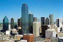
Dallas Love Field Airport (DAL)
Driving Directions / Travel by Car
(Dallas, Texas - TX, USA)

Serving the downtown Dallas area, the busy Dallas Love Field Airport (DAL) is the city's closest airport. The airport is positioned conveniently close to the I-35E (Stemmons Freeway), US-75 (North Central Expressway) and the North Tollway, and is located less than ten minutes northwest of downtown.
Prominent roads surround Dallas Love Field Airport include the NW Highway, Lemmon Avenue, Airdrome Drive, Harry Hines Boulevard and West Mockingbird Lane, which leads to Cedar Springs Road within the complex itself. Significant points of reference close to the airport include the Bachman Lake Park to the northwest, the Brook Hollow Golf Course to the south, and the University Park to the east.
Directions to Dallas Love Field Airport (DAL) from the north:
- Take the US-75 highway or Dallas North Tollway and turn off at the Mockingbird Lane exit. Head west on Mockingbird Lane
- Turn right onto Cedar Springs Road and proceed to the terminal building
Directions to Dallas Love Field Airport (DAL) from the south:
- Take the I-35E interstate northwest through Dallas and turn off at the Mockingbird Lane exit. Head east on Mockingbird Lane
- Turn left onto Cedar Springs Road and proceed to the terminal building
Directions to Dallas Love Field Airport (DAL) from the east:
- Take Mockingbird Lane east to Cedar Springs Road
- Turn left onto Cedar Springs Road and proceed to the terminal building
Directions to Dallas Love Field Airport (DAL) from the west:
- Take the I-35E interstate east and turn off at the Mockingbird Lane exit. Head east on Mockingbird Lane
- Turn left onto Cedar Springs Road and proceed to the terminal building
Dallas can become very busy during peak hours and during popular holidays, so leave plenty of time to reach the airport if checking in at Love Field Airport during these times.
Dallas Love Field Airport (DAL): Virtual Google Maps
 Serving the downtown Dallas area, the busy Dallas Love Field Airport (DAL) is the city's closest airport. The airport is positioned conveniently close to the I-35E (Stemmons Freeway), US-75 (North Central Expressway) and the North Tollway, and is located less than ten minutes northwest of downtown.